Services Survey and GIS
Description
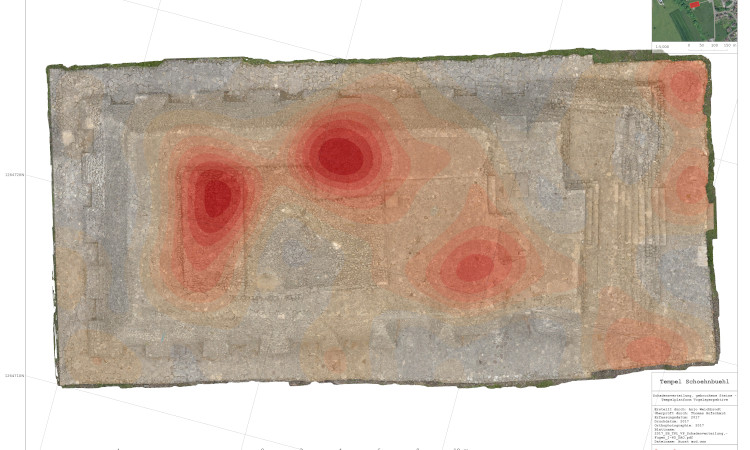
Conservation projects require a great deal of visual documentation. We know how to do this.
We realize documentation work on orthographic images created through digital photogrammetry. Observations are annotated with the help of a GIS.
